Imagine, you’re trekking through the wilderness, armed only with a backpack and the silent whispers of the forest around you. “Mapping and GPS Skills for Campers” unfolds the skills you need to conquer unchartered territories using navigational tools and strategies. You’ll learn how to interpret maps with confidence, make sense of compass directions, master the modern GPS system, and ultimately navigate your way with assurance and safety. So, gear up and get ready for an enlightening adventure of discovery and learning.
Understanding The Basics of Maps
Maps are an indispensable tool for navigation, especially when you are out camping in the wilderness. They offer a schematic representation of the physical environment, allowing you to understand the layout of the land. With a well-drawn map and the knowledge to read it, you can chart your course and reach your destination safely.
Importance of Maps While Camping
When you’re camping, being equipped with a map not only gives you a sense of direction but also helps ensure your safety. Maps can aid you in identifying potential dangers in your path such as steep ravines or water bodies. They can also help you locate campsites, water sources, and trails. Plus, in the unfortunate case of getting lost, a map can be your lifesaver.
Different Types of Maps
There is a variety of maps available. Topographical maps are the most common ones used by campers due to their detailed depiction of the land’s physical features. Road maps show highways, streets, bridges and more, helpful for understanding human-made structures. Then there are thematic maps that display information on specific subjects, like soil type, vegetation or climate.
How to Read Different Types of Maps
Reading a map necessitates knowledge of its key components, namely the title and the legend. The title tells you what the map depicts, and the legend interprets the symbols used on the map. Next, it’s important to understand the map’s scale and direction. Scale represents the ratio of distance on the map to the corresponding distance on the ground. Direction is usually indicated by the compass rose, which points to the geographical North.
Introduction to GPS
In our technologically advanced era, GPS (Global Positioning System) devices have become a staple in navigation.
What is GPS
GPS is a satellite-based navigation system that provides real-time location and time information. It uses signals from multiple satellites to determine the exact location of a device, anywhere around the globe.
Importance of GPS in Camping
When you’re camping, a GPS device can be a reliable companion. It can guide you through unfamiliar terrain, help you track your progress, and easily lead you back to your starting point. A GPS device also allows you to mark waypoints, like your campsite or points of interest, so you can return to them with ease.
How to Use a GPS Device
Operating a GPS device involves understanding its basic functions and features. Firstly, you need to turn on the device and let it lock onto satellite signals. Once it picks up a strong signal, it can give you your current location. You can then enter your destination and the device will provide directions. Remember to familiarize yourself with key terms like ‘waypoints’, ‘routes’, and ‘tracks’, commonly used in all GPS devices.

Topographical Maps: A Camper’s Guide
Topographical maps are a type of map that represents the earth’s physical features in detail.
Understanding Topographical Maps
These maps use lines, symbols, and colors to depict the terrain and its elevation, making them useful for activities like hiking, biking and camping. They offer a three-dimensional perspective of the terrain on a two-dimensional surface.
Essential Symbols and Markers
Every topographical map includes a variety of symbols and markers. Natural features like mountains, valleys, rivers, and forests are represented with specific symbols. Similarly, man-made structures like roads, trails, bridges and buildings also have unique symbols. Understanding these symbols is key to extracting the most information from the map.
Reading Contour Lines and Elevation
Contours are the wavy lines that you see on a topographical map. Each contour line represents a specific elevation, and the successive lines indicate changes in elevation. Closer lines mean a steep slope, while far-apart lines indicate a flatter terrain. The number on the lines denotes the exact elevation, usually in meters or feet.
Compass Navigation: Old School, But Still Effective
While GPS devices are gaining popularity, the good old compass remains an essential navigation tool.
Understanding a Compass
A compass is a straightforward device that indicates direction relative to the geographic cardinal directions. The floating needle in a compass always points towards the magnetic North, thereby helping you orient yourself.
How to Use Compass in Conjunction with a Map
A compass and map work excellently together. Place the compass on the map with its edge along your chosen route. Rotate the bezel until ‘North’ on the compass points to North on the map. The compass is now aligned with the map and you can hold it in front of you and turn until the compass needle aligns with the lines on the bezel, showing you the direction you need to travel.
Aligning Map to Magnetic North using Compass
To align your map with the magnetic North, place your compass on the map and rotate the map until the compass needle aligns with the North markers on the map. Remember, the red end of the compass needle always points to magnetic North.

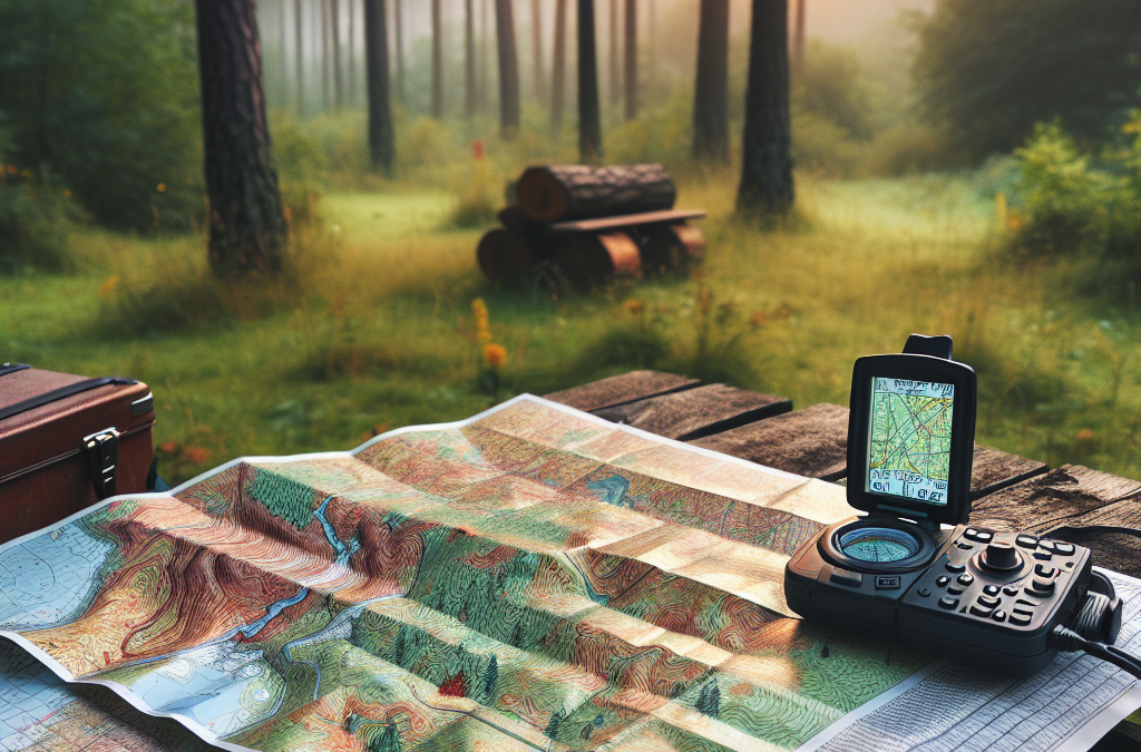
GPS Devices for Camping
Getting a GPS device for camping can elevate your navigation game.
Types of GPS Devices
Handheld GPS units are the most common type used in outdoor activities. Smartphone GPS applications are also popular due to their convenience. Additionally, there are GPS watches and GPS-enabled fitness trackers that cater specifically to hikers and runners.
Features to Look for in a GPS Device for Camping
When choosing a GPS device for camping, key features to look for include accuracy, durability, battery life, and good satellite reception. Other handy features could include topographical map display, waypoint marking, backtracking, and weather prediction tools.
Maintaining and Protecting Your GPS Device
To ensure your GPS device lasts long and performs well, make sure to protect it from harsh weather conditions and physical damage. Regularly update it to receive accurate information. Also, remember to change or charge the batteries frequently to prevent sudden power losses.
Understanding GPS Coordinates and Grid References
When you’re navigating unfamiliar terrain, understanding GPS coordinates and grid references will be extremely beneficial.
Navigating Using GPS Coordinates
GPS coordinates, consisting of latitude and longitude values, pinpoint exact locations on the earth. These coordinates can be used to navigate to specific locations. Simply input the coordinates into your GPS device to get directions to that particular location.
Understanding Different GPS Coordinate Systems
There are various coordinate systems used in GPS devices, including Decimal Degrees (DD), Degrees Decimal Minutes (DDM), and Degrees Minutes Seconds (DMS). Depending on personal preference and the specific GPS device, you can switch between these coordinate systems.
How to Use Grid References
Grid references refer to the alphanumeric codes used on maps to denote specific locations. Each square on the map grid has a unique identifier. You can use these grid references with your map to locate a particular position.
Using GPS to Locate Camping Grounds
Your GPS can be an invaluable tool in finding the best camping grounds.
How to Find Camping Grounds on Map using GPS
Most GPS devices allow you to search for points of interest, including campsites. By inputting ‘campsite’ or ‘campground’ into your GPS device, it can provide directions to the nearest camping grounds. Some devices and apps also allow you to download maps with campsites marked.
Verifying Location on Map
Before setting off, it’s essential to verify your location on the map. Make a note of your GPS coordinates and cross-check them on the map. This will ensure you’re indeed headed towards your desired camping ground.
Important Tips when Locating Camping Grounds using GPS
Remember, a GPS device should be used as a tool, not a crutch. Always carry a physical map and compass as backup. Also, never solely rely on your GPS for finding campsites, as they might not always be updated or accurate. Use it alongside other resources like guidebooks and trail maps.
Using GPS and Maps for Route Planning
Strategic route planning is essential for a successful and enjoyable camping trip.
How to Plan Routes using GPS and Map
Your GPS device can be used to plan your route effectively. Mark waypoints, such as your campsite, water sources, and scenic viewpoints, on the GPS device. Then, connect the waypoints to form a route. Parallelly, use a physical map to gain a larger overview of the area and confirm your planned route.
Importance of Backup Routes
Sudden changes in weather or unexpected obstructions might necessitate a need to alter your route. Hence, always plan for alternate routes and mark them on both your GPS and map.
Calculating Distance and Time for Routes
Most GPS devices can calculate the distance and time it’ll take to traverse a route. This information can be helpful in planning your day and ensuring you get to your campsite before dark.
Tips for Combining GPS and Map Skills
Having both GPS and map skills gives you an advantage in navigation.
When to Rely on GPS or Map
A GPS device is great for pinpoint accuracy and immediate feedback. It’s useful when navigating dense forests or badly marked trails. Maps, on the other hand, are ideal for getting a broader perspective of the terrain and planning long, complex routes.
Benefits of Using Both GPS and Map Simultaneously
By using a GPS device and map together, you get the advantages of both. You can use the GPS for rapid feedback and the map to visualize your overall route. This combination can enhance your situational awareness and help keep you on track.
Backup Options for Map and GPS Failures
Cold temperatures, dead batteries, or technical glitches can render your GPS device useless. Therefore, always carry a physical map and compass as a backup. Similarly, a map can get lost or damaged, underscoring the importance of having a GPS device as an alternative.
Preparing for Unexpected Navigation Challenges
Regardless of your best preparations, unexpected navigation challenges may arise in the wilderness.
Understanding Map and GPS Limitations
Both maps and GPS devices have their own limitations. Maps can get outdated or damaged, and they don’t offer real-time location tracking. GPS devices, on the other hand, can run out of battery or lose signal in remote areas. It’s vital to be aware of these limitations and be prepared to work around them.
Dealing with Lost or Broken GPS Device
In case you lose or break your GPS device, don’t panic. Rely on your map and compass for navigation. If possible, backtrack your steps to familiar grounds. Always note down key information such as campsite locations or important landmarks, in case you need to ask for directions from other campers or forest rangers.
Overcoming Difficulties with Reading Map under Poor Lighting or Weather Conditions
Poor lighting or bad weather can make it hard to read a map. Always carry a headlamp or a small torch with you for lighting. To protect your map from rain or snow, keep it in a waterproof case or a zip-lock bag.
Mapping and GPS skills can take your camping experience to the next level. With these skills, you can explore the wilderness with greater confidence and safety. So go ahead, embrace the advent of GPS technology, but don’t forget to keep that map and compass handy. Happy camping!