Embarking on an adventure into the wild? This comprehensive guide on “Hiking Safety: Navigation and Emergency Procedures” is tailor-made just for you. As you wander through exciting trails and embrace nature’s grandeur, you need to be equally guarded with knowledge about safe navigation and emergency handling. Your safety becomes paramount, especially when you are miles away from civilization. This article will equip you with insights on how to keep track of your path, recognize signs of danger, and implement key emergency procedures. So grab your rucksack and let this safety guide lead you on your most secure hiking adventure yet.
Understanding Topographical Maps
Topographical maps, otherwise known as contour maps, provide a detailed and accurate graphic representation of the features that appear on the Earth’s surface. They allow you to visualize the highs and lows of the land around you, providing physical and human-made features.
The basics of reading topographical maps
Unfolding a topographical map is like opening a book filled with information about the terrain you’ll be covering. On one side, you’ll see squiggly lines, symbols, and notes – each representing different aspects of the land. It’s essential to understand the map’s orientation, scale, and legend.
Symbols and markers on maps
Each color, line, and symbol on your map represents something unique. Brown lines known as contour lines show elevation and the shape of the land. Other colors represent various elements: blue for water, green for vegetation, black for man-made constructions and white for bare, open land.
Determining elevation and distance
Contour lines on your map indicate the land’s elevation. Closely spaced lines represent steep slopes, while lines farther apart denote a more gradual slope. Using the scale of your map, you can also estimate the distance between different points.
Using a Compass and Map Together
While a topographic map can tell you where you are, a compass can help you go where you want to go.
Aligning the map and compass
The first step in using a compass with a map is to align the two. To do this, align the compass’s edge with the map’s grid lines pointing to the North. Then, rotate the compass dial until North (N) aligns with the compass needle’s red end.
Calculating and following bearings
Bearing is the direction from one place to another, measured in degrees from North. To calculate and follow bearings, you need to plot your course on the map, align your compass, and then follow the needle.
Navigating obstacles along your path
Despite your best efforts planning your hike, you can encounter physical obstacles like rivers, boulders, or fallen trees. Using a map and compass together can help you navigate around these obstacles, keeping you on your intended bearing and preventing unnecessary detours.

GPS Technology for Hiking
GPS (Global Positioning System) technology, thanks to advances in miniaturization and digital mapping, has become a common aid for hikers.
Choosing a reliable hiking GPS
When choosing a hiking GPS, you should consider factors like battery life, reliability of signal in dense foliage, and if the GPS has pre-loaded maps relevant to the area you’ll be hiking.
Basic GPS operations and functions
A GPS device receives information from at least 4 GPS satellites, calculating its exact location coordinates. This information can then help you determine your location on a digital map, track your paths, mark waypoints, and even give you direction.
The benefits and limitations of GPS technology
GPS devices offer many benefits, including the ability to pinpoint your exact location and provide reassurance in inclement weather conditions when visibility may be poor. On the other hand, GPS technology has its limitations. The devices are dependent on batteries and may fail if those batteries run out or the technology malfunctions.
Trail Marking Techniques
Trail marking techniques can help guide you along your hike and help prevent you from becoming disoriented.
The Leave No Trace philosophy
The Leave No Trace philosophy reminds us to respect the outdoors by minimizing our impact. When marking a trail, it’s essential to avoid damaging the environment.
Hiking trail markers and blazes
Trail markers, also known as blazes, are often colored paint marks or plastic or metal markers. They guide hikers along the trail. It’s important to understand the different types of blazes, and what they represent.
Using natural landmarks as guide
Besides trail markers, natural landmarks can serve as neurological memory anchors that are immensely useful on your return trip or if you happen to lose your way.

Planning and Preparing for Your Hike
Successful hiking trips start with careful planning and preparation.
Researching your route in advance
Knowing your route can help prevent you from getting lost. Make sure to study your path beforehand. Know the key landmarks, understand the terrain, and familiarize yourself with any trail markers.
Preparing and sharing your hike plan
Before you head out on your hike, prepare a plan detailing your intended route, expected return time, and any medical conditions. Make sure to share this with someone reliable who can call for help if you don’t return as planned.
Checking weather conditions
Weather conditions can greatly impact your hiking experience. It can make trails more difficult and dangerous. Make sure to check weather forecasts regularly in the days leading up to your hike.
Hiking Essentials and Survival Gear
Pack wisely for your trip. It’s important to have the right gear to ensure your safety and comfort during the trip.
The Ten Essentials for outdoor survival
First proposed in the 1930s by The Mountaineers, a Seattle-based hiking, and climbing club; the original Ten Essentials list included a map, compass, sunglasses and sunscreen, extra clothing, headlamp/flashlight, first-aid supplies, fire starter, matches, knife, and extra food.
Additional tools and equipment for emergencies
In addition to the ten essentials, it is wise to pack additional tools and equipment: a multi-tool, duct tape for gear repair, a thermos with hot drinks for warmth and morale, and a bivy sack or space blanket for emergency shelter.
Packing your backpack efficiently
How you pack your backpack can affect your comfort. Keep your gear balanced, and put items you’ll need frequently near the top or in easily accessible pockets.
Knowing the Signs of Getting Lost
Everyone gets a bit disoriented sometimes – the key is to realize it before you get seriously lost.
Common signs of being lost
You may be lost if you don’t recognize your surroundings, if your map and the terrain seem to disagree, or if an expected feature such as a creek, trail junction, or summit does not appear within the time frame you calculated.
Preventing panic and staying calm
When you feel lost, it’s vital to stay calm. Panic leads to poor decisions. Stop, sit, have a drink and a snack, and think things through.
Steps to take when you realize you are lost
When you realize you are lost, remember the acronym STOP: Stop, Think, Observe, Plan. Stop moving, think about what you know, observe your surroundings, and make a plan.
Basic Wilderness First Aid
Things can and do go wrong in the wilderness. It can range from blisters and sprains to more serious injuries.
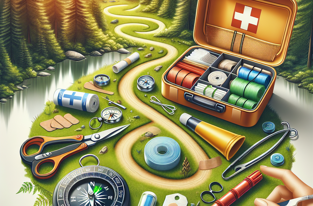
Building a hiking first aid kit
a hiking first aid kit should contain treatments for blisters, adhesive bandages of various sizes, several gauze pads, adhesive tape, disinfecting ointment, over-the-counter pain medication, pen and paper.
Basic treatment for common hiking injuries
The most common hiking injuries include blisters, sprains and strains, cuts, and hypothermia. It is beneficial to learn how to treat these common injuries.
Recognising and treating hypothermia and heat stroke
Hypothermia and heat stroke can be life-threatening conditions. Learn the symptoms and treatments for both.
Emergency Communication and Signalling
In the event of an emergency, being seen and heard can make all the difference.
Using a whistle to signal distress
A whistle is lightweight, compact, and much louder than the human voice. It can be heard over long distances and offers an energy-efficient way to signal for help.
Creating a signal fire
A signal fire is another way to attract attention. A fire produces smoke that can be seen from miles away, signaling your presence to rescuers.
Emergency hand and light signals
Knowing the standard emergency hand and light signals can aid in communication, especially when trying to signal aircraft overhead.
Rescue Scenarios and Procedures
If you’ve summoned help or know it’s on the way, what do you do next?
When to stay put and when to move
If you’re lost, it’s usually a good idea to stay put. If you’re injured or the weather is bad, the same rule applies. On the other hand, if you need to signal rescuers or leave a dangerous location, moving may be necessary.
Making yourself visible for rescuers
Signal by laying out bright clothing or gear, using a flashlight or cell phone light, or creating signals in the snow or sand.
Surviving an overnight stay in the wilderness
Surviving an overnight in the wilderness requires a good attitude, some survival skills, and knowledge of first aid. Choose a sheltered spot to hunker down and stay warm by layering clothing and using any gear you have. Stay hydrated, but avoid eating if you don’t have a lot of water.